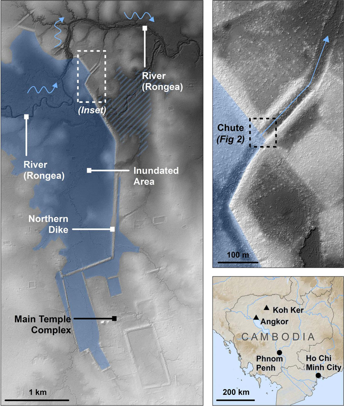
The detailed map area (top right) is shown as a white dashed box on the regional map (left). The black dashed line in the detailed map area shows the approximate area of Fig 2. The location of Koh Ker compared with Angkor, Phnom Penh, and Ho Chi Minh City is shown in the bottom right. North is up in all figures
This image is embedded in ...
- Ground penetrating radar reveals why ancient Cambodian capital was moved to Angkor, Thursday, October 31, 2019 - 12:00